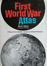
GILBERT : First World War atlas (fülszöveg)
This important new atlas provides a thorough visual history of the First World War. The 170 maps offer a wealth of factual information and statistical detail. Depictions of the origins of the war are followed by maps of all the individual campaigns and the strategies for the battles at sea and in the air. In addition to tracing military history and logistics, the atlas fully illustrates political, diplomatic, economic, and social aspects of the war.
Each map and its accompanying legend are carefully planned and designed to provide a graphic, visual narrative of the Great War in such a way that all relevant data can be easily understood. The comprehensive nature of this atlas is reflected in the following representative selection of maps contained in the book:
EUROPEAN FEARS AND AMBITIONS BEFORE 1914
THE EUROPEAN POWERS ON AUGUST 4, 1914
THE GERMAN ADVANCE AUGUST–SEPTEMBER 1914
THE WAR IN THE FAR EAST 1914
ALLIED TRENCHES ON GALLIPOLI: THE "HELLES" FRONT IN JULY 1915
ALLIED PLANS FOR TURKEY 1915–1917
THE FIRST PHOSGENE GAS ATTACK DECEMBER 1915
CHURCHILL IN FLANDERS 1916
RAIL COMMUNICATIONS OF THE CENTRAL POWERS 1916
THE BALKANS IN 1916
BRITISH MINE BARRAGES IN THE DOVER STRAIT 1914–1918
A TYPICAL CONVOY 1917–1918
THE RUSSIAN REVOLUTION NOVEMBER 1917 – MARCH 1918
THE AMERICAN EXPEDITIONARY FORCE 1918
GERMAN DIPLOMACY 1914–1918
INDIA AT WAR 1914–1918
BRITISH LABOUR CORPS 1914–1918
GOLD LOSSES 1914–1918
THE PROPOSED UNITED STATES' MANDATES 1919
THE RUSSO-POLISH WAR 1920
THE NEW STATES OF CENTRAL EUROPE 1920
TRENCH WARFARE: THE AFTERMATH
|
|

|
|
| KATALÓGUS | TARTALOM |